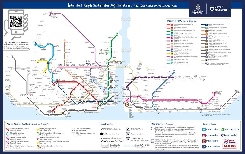
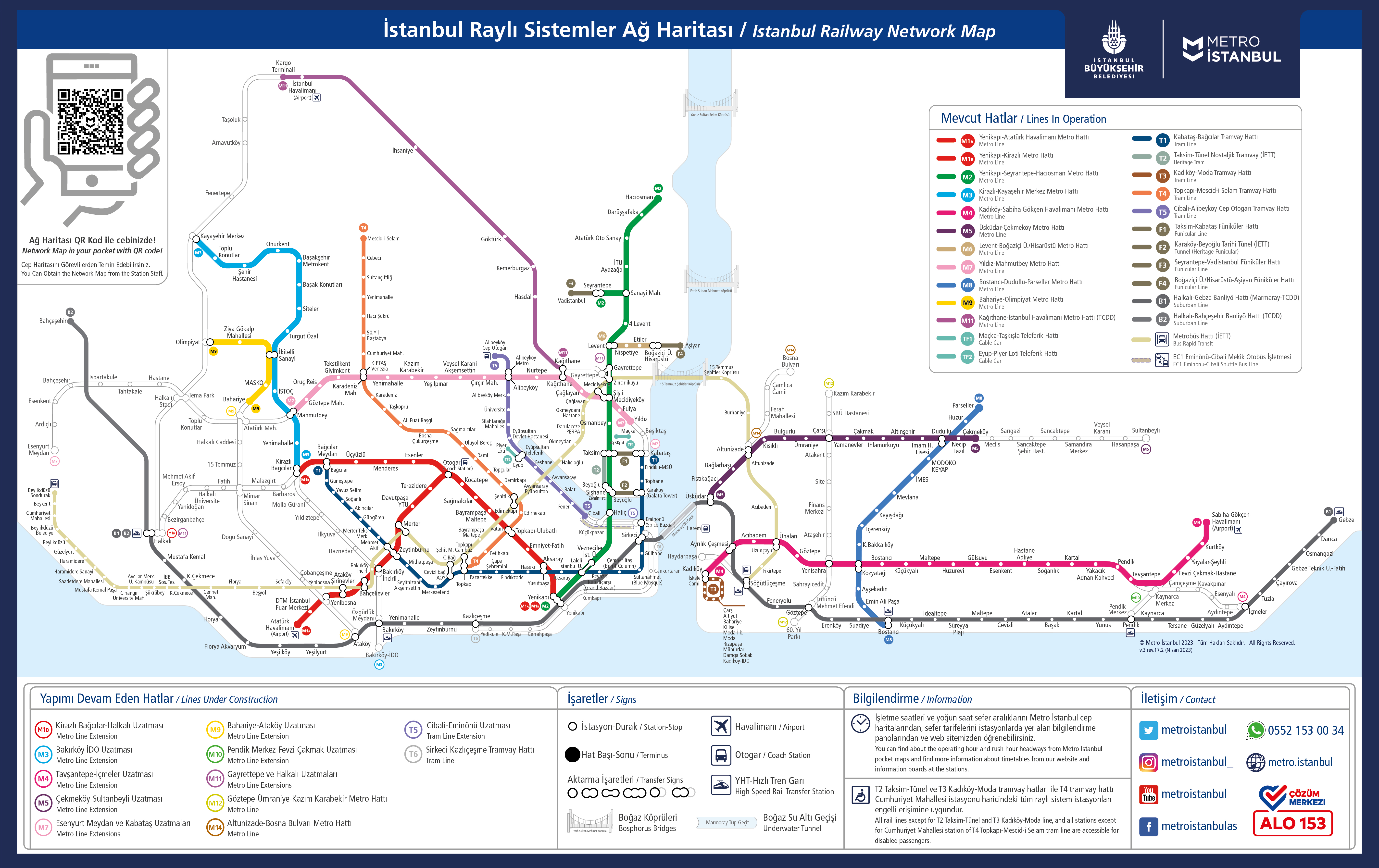
Istanbul Marmaray train map
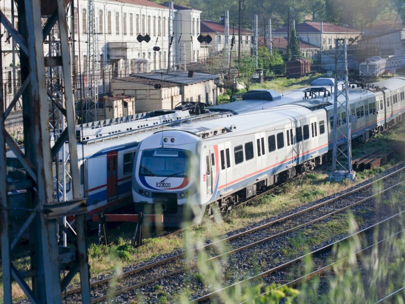
Marmaray provides an uninterrupted railway connection between the two continents by connecting the European and Asian sides in Istanbul. This connection, which serves to alleviate traffic congestion in the city, helps city residents to travel more efficiently. Here you can find the most up-to-date map of Marmaray.
The Marmaray line, also known as the Halkalı-Gebze line, was put into operation on March 12, 2019. The train line, which was previously the Haydarpaşa – Gebze line, was built from scratch and connected to the Halkalı – Sirkeci line built on the European Side via the Marmaray Tunnel and to the Ayrılık Çeşmesi line, which is the last stop on the Anatolian Side. Finally, the Halkalı – Bahçeşehir line was built and the Marmaray line was extended.
Istanbul Marmaray map
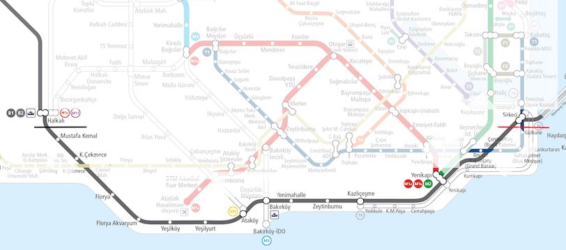
[toc]Halkalı – Gebze Line European Side part*Halkalı – Gebze Line Asian Side part*Halkalı – Bahçeşehir Line*Marmaray map full version[/toc]We have divided the line into 3 so that you can view the map more easily on the page. We start with the European side part, continue with the Anatolian side part and end with the Bahçeşehir part. You can also open the full version map of the line from the link at the bottom.
B1 Halkalı - Gebze Line European Side part
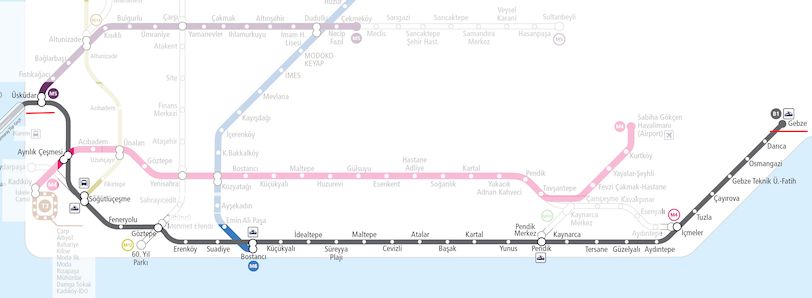
B1 Halkalı - Asian Side of Gebze Line
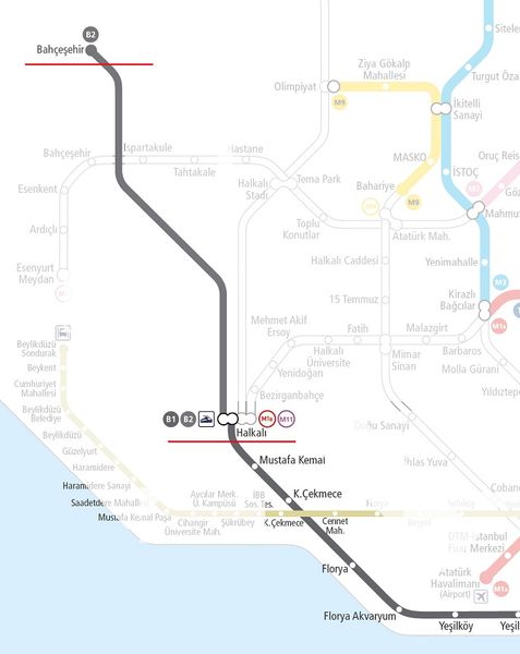
B2 Halkalı - Bahçeşehir Line
Marmaray map full version
From this link you can open the full-size version of Istanbul’s Marmaray map.